
Start with the set, not the measurement tool
Civil plans describe site work such as grading, drainage, paving and utilities. A plan view shows the work from above. A section cuts through it. A detail explains a particular construction condition. Written specifications may add material, installation and testing requirements.
No single sheet necessarily tells the whole story. An estimator’s first job is to establish the documents available for the assignment and understand their relationships.
1. Confirm the issue and drawing index
Read the cover or index, sheet identifiers, issue dates and revision blocks. Compare the files you received with the document register. A revision cloud identifies a changed area, but does not replace reading the revised note or detail.
An addendum changes issued bid information. A request for information, or RFI, asks for clarification and may receive a response that affects the bid basis. Record those documents with the sheets they concern. Do not choose a governing requirement just because one file was downloaded later.
2. Read the legend and general notes
Identify how that particular set distinguishes existing work from proposed work. Check line types, symbols, abbreviations and units. Do not assume every designer uses the same graphical convention.
On a grading plan, contours connect equal elevations of the stated surface. Closer spacing commonly indicates a steeper slope when the contour interval and drawing scale are comparable. Spot elevations define selected points. Confirm whether a label refers to finish grade, a curb feature or another surface before using it.
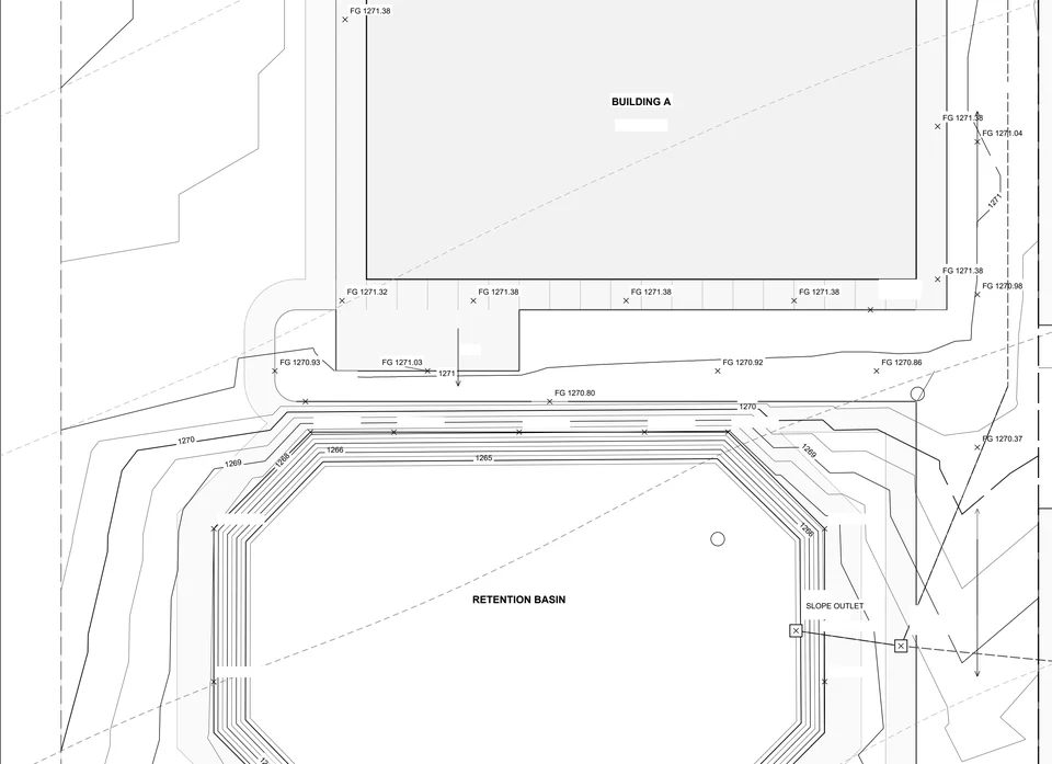
This sanitized Project 001 preview shows document character only. Do not measure it or infer missing elevations from it.
3. Follow the note and detail references
A paving boundary tells you where a surface is located. Its designation should lead to a section or note explaining the layers. A drainage symbol may point to a structure detail. Keep the plan, detail and specification references together in the takeoff record.
For example, measuring the area of a sidewalk does not establish its concrete thickness, base preparation, reinforcement or demolition scope. Those are separate requirements to trace. A quantity that uses the right arithmetic but the wrong construction section is still unreliable.
4. Verify scale before measuring
Check the printed scale and any separate detail or viewport scales. A PDF may have been resized. Calibrate against a reliable known dimension and check a second independent dimension before using measurements. If the checks disagree, stop and investigate the source or scaling rather than forcing a plausible total.
Bluebeam’s current instructions describe setting a page scale manually or calibrating it from a known length. They also distinguish page and viewport scales. Tool steps depend on the product version and entitlement. See Bluebeam’s page-scale guidance.
5. Define the item before tracing it
Original training scenario: a fictional plan shows an 18-foot by 35-foot rectangle labeled “new surface.” Its plan area is 18 × 35 = 630 square feet. That arithmetic answers only the area question. If the material designation points to an unread detail, the material scope is not yet established.
A traceable record would retain the location and dimensions and identify the missing detail as an open item. It would not quietly assume asphalt, concrete or a particular thickness.
6. Record conflicts and the information needed
If an architectural sheet and a civil sheet disagree, identify both references and the affected location. Follow the project’s clarification and document-control process. There is no universal rule that one discipline always controls every conflict.
For a handoff, record the source sheet and revision, measurement method, unit, quantity and any unresolved assumption. Keep superseded information as history where required, while making the current working source unmistakable.
Put the review into practice
Before the next measurement, answer three questions: Which issued source am I using? What exactly is included? How will another person check this result?
Quantity Takeoff vs. Estimate explains what the quantity record does and does not establish. Civil Estimating Foundations, coming soon, connects document control, plan reading and bounded takeoff through one original training project. Return to all resources.